Where should you go in Puerto Rico, and what's worth booking ahead? Start in Old San Juan for the forts and colonial streets. Add El Yunque's rainforest and a bioluminescent bay to the east, then take the ferry to Vieques for Mosquito Bay or Culebra for Flamenco Beach. Save the west and south for Rincón's surfing and the karst caves. Puerto Rico is a US territory: US citizens travel there without a passport, and every price runs in US dollars.
- See both San Juan forts on one $10 ticket. Castillo San Felipe del Morro and Castillo San Cristóbal share a combined entrance good for 24 hours.
- Book ahead: the Vieques or Culebra ferry, bio bay kayak tours, El Yunque's road entry and El Portal center, Casa Bacardí's tasting and Toro Verde's Monster zipline.
- Go December to March for dry weather, or May to August for fewer crowds; June 1 to November 30 is hurricane season.
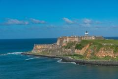
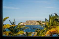
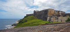
Old San Juan
Worth a visitUNESCOGo for the forts, the cathedral, the colonial streets
Top sights
- Castillo San Felipe del Morro + Castillo San CristóbalUNESCO$10 combined, one receipt for both, 24 hours; children 15 and under free
- La Fortalezafree to view from the street; the interior is closed except for scheduled tours; part of the same 1983 UNESCO listing
- Catedral Basilica Menor de San Juan Bautistathe second-oldest cathedral in the Americas, and the resting place of Juan Ponce de León
- Paseo de la Princesafree waterfront promenade along the old city wall
No advance booking needed
Read the full sectionShowing Old San Juan
The 5-day itinerary stays in San Juan; the 7-day itinerary adds three days in Vieques. A MonkeyEatingMango itinerary marks each sight Must-do, Maybe or Skip if short on time.
San Juan and Old San Juan
Old San Juan
- Castillo San Felipe del Morro + Castillo San Cristóbal: $10 combined, one receipt for both, 24 hours; children 15 and under free; UNESCO (1983)
- La Fortaleza: free to view from the street; the interior is closed except for scheduled tours; part of the same 1983 UNESCO listing
- Catedral Basilica Menor de San Juan Bautista: the second-oldest cathedral in the Americas, and the resting place of Juan Ponce de León
- Paseo de la Princesa: free waterfront promenade along the old city wall
- Plan it: 5-day Puerto Rico itinerary
One $10 ticket covers both of Old San Juan's forts for 24 hours, and the site is cash-free, so bring a card. See Castillo San Cristóbal first, the larger of the two, built to defend the city from an attack by land rather than sea. Finish on Castillo San Felipe del Morro's lawns at sunset, a popular kite-flying spot. The 1983 UNESCO listing covers La Fortaleza, the governor's residence, both forts, a third harbor-mouth fort called El Cañuelo, and most of the old city wall.
Founded in 1521, Old San Juan still holds the narrow, colonial-era streets that grew up around those defenses. The Catedral Basilica Menor de San Juan Bautista, a few blocks in, holds the tomb of the Spanish conquistador Juan Ponce de León. The Paseo de la Princesa runs along the harbor side of the old wall, a shaded, flatter walk than the cobblestone lanes above it.
After dark, Old San Juan's nightlife centers on Calle San Sebastián, home each January to the San Sebastián Street Festival. A few miles away, La Placita de Santurce, a produce market by day, turns into an open-air bar scene after sunset.
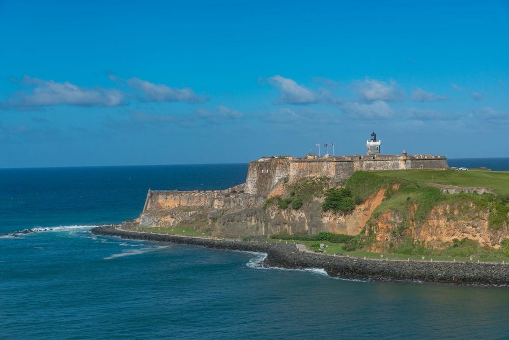 Photo by Diego F. Parra on Pexels
Castillo San Felipe del Morro above the ocean in Old San Juan
Casa Bacardí
- Distillery tour and tasting: a mixology class is also offered
Casa Bacardí fits into an Old San Juan day: a short ferry ride across San Juan Bay to Bacardí's rum distillery and visitor center, laid out as a tropical Art Deco campus. Reserve the tasting or the mixology class ahead.
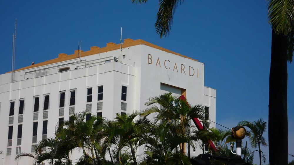 nakashi (CC BY-SA 2.0)
Casa Bacardí in Cataño
The east: El Yunque, Fajardo and Luquillo
El Yunque National Forest
- El Portal visitor center: $8 adult, $4 with a federal interagency pass; reserve it through recreation.gov
- Forest road: a vehicle reservation on recreation.gov is required; the road admits only a limited number of cars at a time
- La Coca Falls: the first waterfall on the forest road
- Luquillo Biosphere Reserve: a UNESCO Man and the Biosphere designation, not a World Heritage Site
El Yunque is the only tropical rainforest in the US National Forest System, its peak rising 3,494 feet above a 28,000-acre reserve in the Sierra de Luquillo. Driving in needs a vehicle reservation on recreation.gov, since the road admits only a limited number of cars at a time; book that and El Portal's visitor center ahead. Expect rain most days, and go in the morning, before the afternoon showers roll in.
The road in passes La Coca Falls first, then climbs toward natural pools and swimming holes further up. The coquí, Puerto Rico's small native frog, is named for its call.
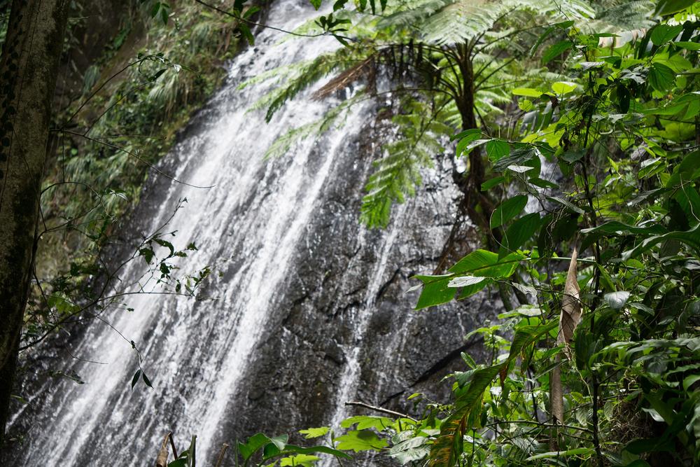 Jami430 (CC BY-SA 4.0)
La Coca Falls in El Yunque National Forest
Fajardo
- Laguna Grande: evening kayak tour through the mangroves to the bioluminescent lagoon, inside the reserve Para la Naturaleza manages
- Cayo Icacos: catamaran or water-taxi day trip to an uninhabited cay for snorkeling
Laguna Grande, inside the Las Cabezas de San Juan Nature Reserve, is the bioluminescent bay to pick if an inter-island ferry doesn't fit the trip. A kayak tour paddles through mangrove tunnels after dark to a lagoon that glows blue-green with every stroke, brightest on a moonless night.
By day, catamarans leave Fajardo's marinas for Cayo Icacos, an uninhabited cay with clear, shallow water for snorkeling.
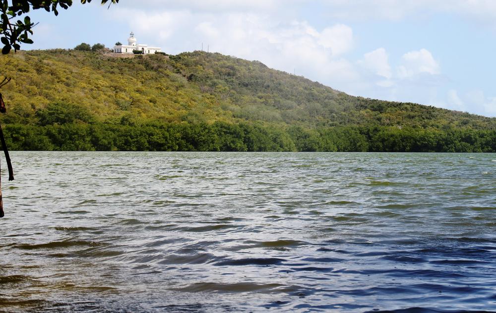 Bjoertvedt (CC BY-SA 4.0)
Laguna Grande in the Las Cabezas de San Juan reserve
Luquillo
- Balneario de Luquillo: calm, family-friendly swimming beach
- Luquillo Kiosks: a roadside strip of more than 60 food stalls
Eat at the Luquillo Kiosks, a strip of more than 60 food stalls. Balneario de Luquillo itself is a calm, family-friendly swimming beach framed by palm trees.
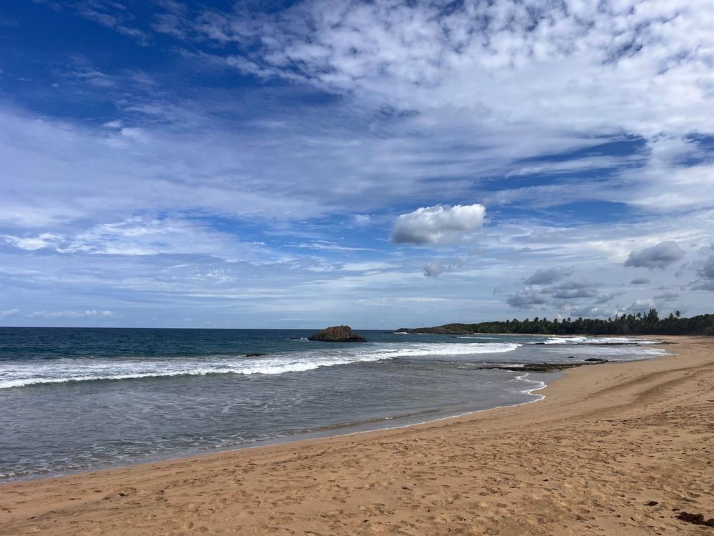 Photo by Matt Khan on Pexels
Gentle waves on Luquillo Beach
The islands: Vieques and Culebra
Vieques
Must-visit
- Mosquito Bay: evening kayak or boat tour; a new moon gives the brightest glow
- Caracas Beach and Playa La Chiva (Blue Beach): quieter, less-developed beaches than the main island's
- Plan it: 7-day Puerto Rico itinerary
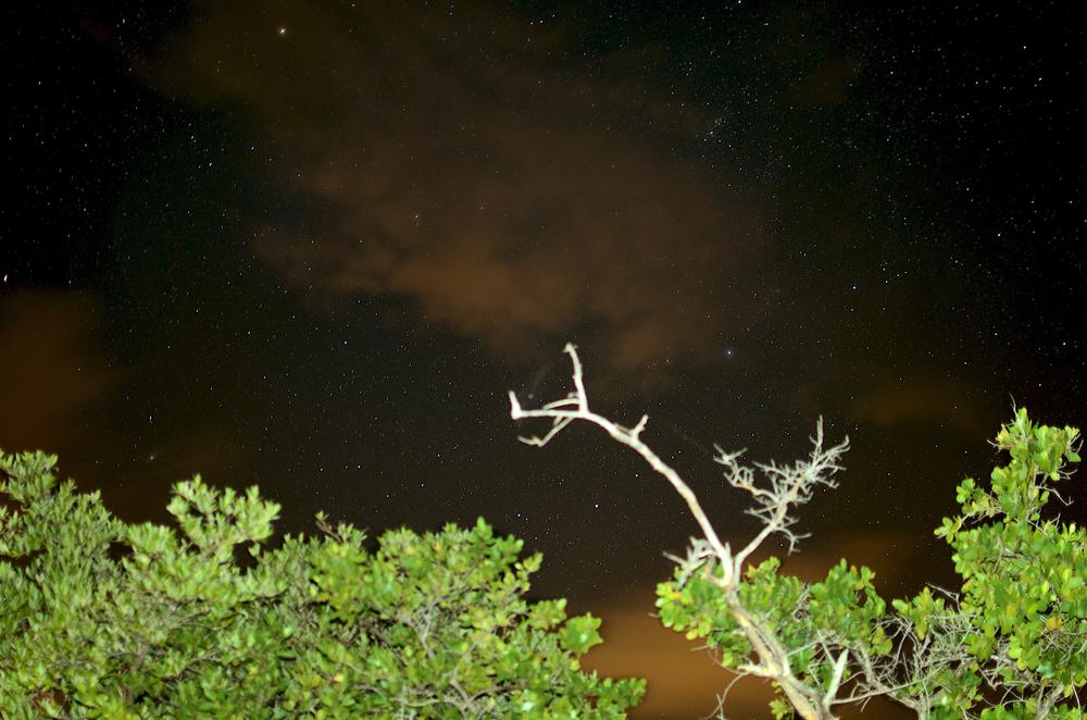
Stay at least one night on Vieques: Mosquito Bay tours run after dark and are best near a new moon. The trip in is a passenger ferry or a short flight, and a bio bay tour can't fit a same-day round trip. Mosquito Bay glows blue-green when the water moves, lit by a dense population of the dinoflagellate Pyrodinium bahamense.
Beyond the bay, Vieques keeps a slower pace than San Juan, with free-roaming horses along its roads. Caracas Beach and Playa La Chiva (Blue Beach) have the same clear, calm water as Culebra's Flamenco Beach.
 Edgar Torres (CC BY 3.0)
Mosquito Bay, the bioluminescent bay on Vieques
Culebra
- Flamenco Beach: public beach (bring cash for the entrance); rusting, graffiti-covered US military tanks sit on the sand from a decommissioned bombing range
- Tamarindo Beach: a quieter secondary beach, good for snorkeling
Flamenco Beach's soft white sand and turquoise water are interrupted by rusting military tanks, left behind decades ago and now covered in graffiti. Pick Culebra over Vieques for Flamenco Beach itself, and Vieques if a bioluminescent bay matters more to the trip. A 20-minute walk south of Flamenco reaches Tamarindo Beach, a quieter stop for snorkeling.
Try free
Plan your Puerto Rico trip in about 2 minutes
Tap through 8 quick cards for a complete itinerary with budget, maps, and packing lists. No account required.
Plan your Puerto Rico trip →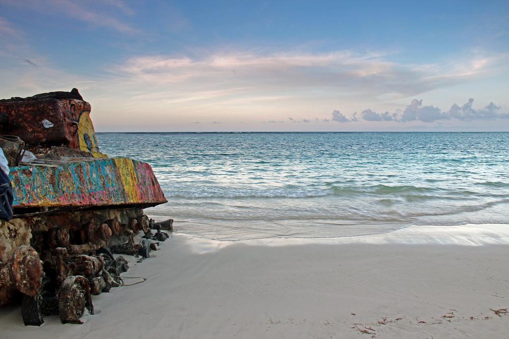 Carolyn Sugg (CC BY-SA 2.0)
A rusting US military tank on Flamenco Beach
The west and south: Rincón, Ponce, the karst caves and the central mountains
Rincón
- Surfing: lessons and board rentals available
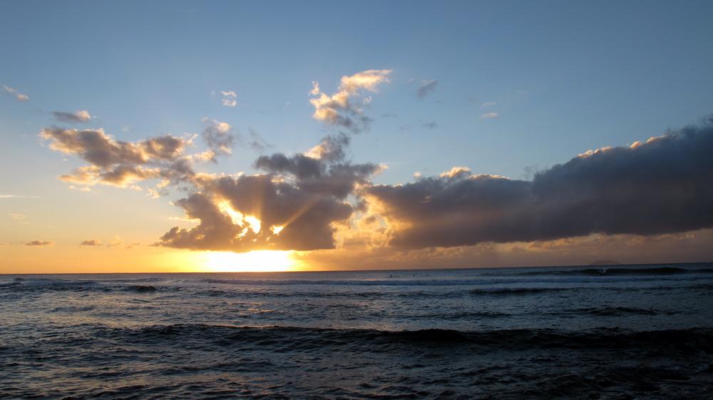
Rincón has drawn surfers of all levels since Domes Beach hosted the 1968 World Surfing Championship. Rincón's beaches face west, toward the sunset.
 M S (CC BY-SA 2.0)
Surfers at sunset at Maria's Beach in Rincón
Ponce
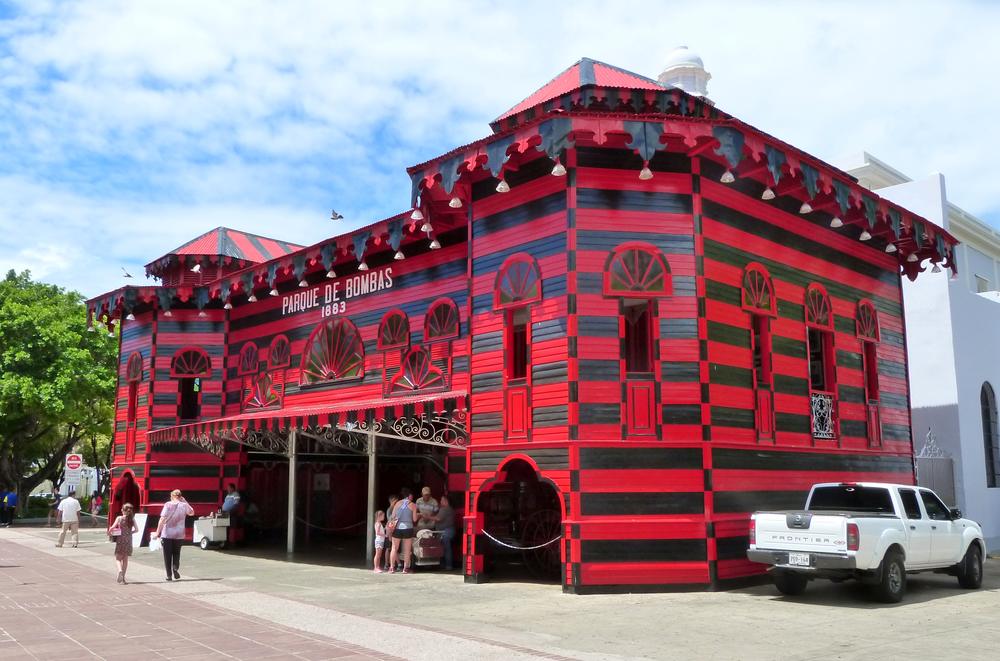
- Parque de Bombas: an 1882 firehouse painted in red and black stripes, now a small museum
- Centro Ceremonial Indígena Tibes: Taíno and Ígneri ceremonial grounds dated to between 400 BCE and 1000 CE
Ponce, known as "La Perla del Sur," the Pearl of the South, works as a day trip from San Juan, 1.5 to 2 hours each way. Parque de Bombas, the striped firehouse, anchors its main plaza.
Outside the city center, Centro Ceremonial Indígena Tibes holds ceremonial plazas and effigies from Puerto Rico's pre-colonial Ígneri and Taíno population.
 Ian Poellet (CC BY-SA 4.0)
Parque de Bombas, the 1882 firehouse on Plaza Las Delicias
Cabo Rojo
- Salinas de Cabo Rojo: free; pink-hued salt flats and lagoons
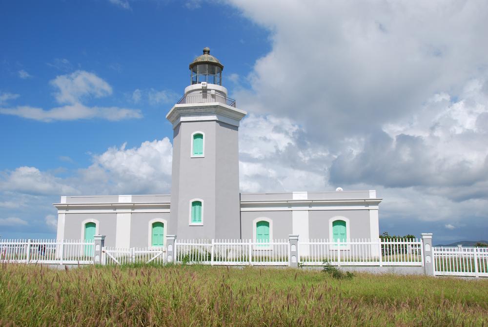
- La Playuela (Playa Sucia): free; a remote beach backed by limestone cliffs, crowned by the Los Morrillos Lighthouse
Pair Cabo Rojo with La Parguera on a west-coast or south-coast trip: the salt flats and La Playuela here by day, the bio bay boat there after dark, both at Puerto Rico's southwest corner.
Salinas de Cabo Rojo's pink-hued salt flats and lagoons sit near La Playuela, also called Playa Sucia, a crescent beach hemmed in by limestone cliffs, watched over by the Los Morrillos Lighthouse from the point above.
 ForgottenColorado (CC BY-SA 4.0)
Los Morrillos Lighthouse in Cabo Rojo
La Parguera
- La Parguera bioluminescent bay: evening boat tour from the village waterfront
La Parguera, a coastal village in Lajas on the south coast, is the bay to pick on a west-coast or south-coast trip. Drive straight to the village, where the boat tours leave from the waterfront.
| Bay | Where | How to reach it |
|---|---|---|
| Mosquito Bay | Vieques | Ferry or flight to the island, then a kayak or boat tour |
| Laguna Grande | Fajardo | Drive to Fajardo, then a kayak tour through the mangroves |
| La Parguera | Lajas | Drive directly; boat tours leave from the village |
All three glow from the same dinoflagellate, Pyrodinium bahamense. Tourism, pollution and hurricanes have strained the bays' ecosystems.
 Hiram A. Gay (Public domain)
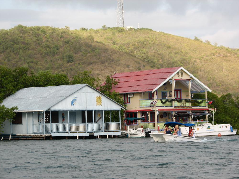
Stilt houses over the water in La Parguera
Arecibo
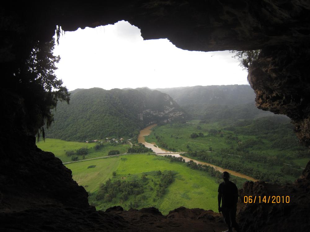
- Cueva Ventana: a paid, operator-run visit; walk through two connected caves to a cliffside opening over the Río Grande de Arecibo valley
- Cueva del Indio: coastal cave with Taíno petroglyphs, reached along the rocky shoreline
Do Cueva Ventana first: its short walk climbs down under a tree's roots and through two linked caves, ending at a limestone window over the Río Grande de Arecibo valley. Add Cueva del Indio, closer to the coast, if Taíno carvings matter more than an easy path; it holds rock carvings and a view of the Atlantic breaking against the shoreline outside its mouth.
 Tom Vazquez (Public domain)
Looking out through the opening of Cueva Ventana
Río Camuy Cave Park
- Guided cave tour: a 45-minute guided walk through Cueva Clara, the main cave; temperatures stay a steady 18–21 °C (65–70 °F) year-round
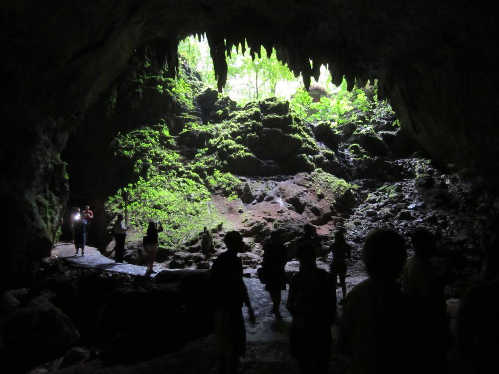
Save Río Camuy Cave Park for the hottest day of the trip: the cave holds a steady 18–21 °C (65–70 °F) year-round. A 45-minute guided walk through Cueva Clara, the main cave, passes an enormous sinkhole. Pick Camuy over Arecibo's caves for the fuller show-cave tour; pick Arecibo for a shorter stop with a view on the way along the coast.
 Per Aspera (CC0)
The entrance of Cueva Clara in Río Camuy Cave Park
Toro Verde Adventure Park
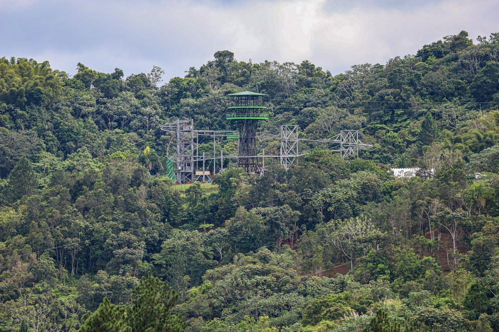
- The Monster zipline: a 1.5-mile cable across the forested hills of the central mountains; book ahead
The Monster suits a thrill-seeker ready for 1.5 miles across the valley at speeds of up to 95 miles an hour; skip it if heights or speed aren't for you. Toro Verde Adventure Park sits in Puerto Rico's central mountains around Orocovis. Reserve a slot well ahead.
 Ligocsicnarf89 (CC BY-SA 4.0)
Toro Verde Adventure Park seen from Gato, Orocovis
Gozalandia Falls
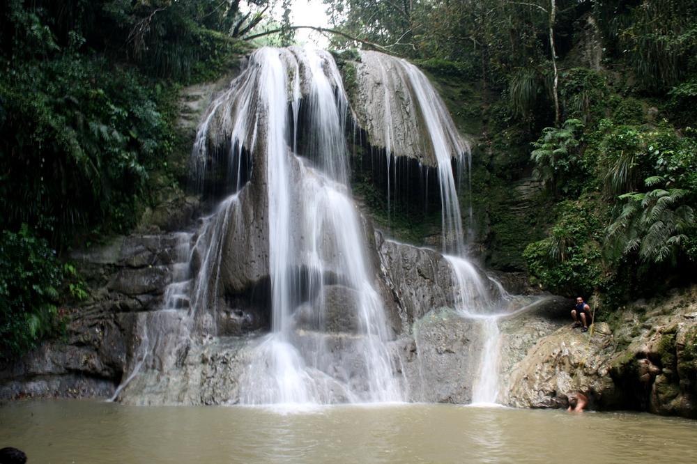
- Gozalandia Falls: free; a series of waterfalls with swimming pools below
Heavy rain changes Gozalandia Falls' water levels fast, so check conditions before swimming. In the hills outside San Sebastián, the falls drop through a series of waterfalls into natural pools deep enough for swimming.
 cavenaghi9 (CC BY-SA 2.0)
Gozalandia Falls in San Sebastián
Guavate / La Ruta del Lechón
- Lechoneras: family-run roadside restaurants serving spit-roasted whole pig; pay per dish, no entry fee
In the mountains above Cayey, the Guavate sector holds a strip of lechoneras built around one dish: slow-roasted, spit-turned pig with crisped skin. Go on a weekday or a weekend morning to skip the afternoon lines. La Ruta del Lechón, the Pork Highway, is a ritual Puerto Ricans keep especially at Christmas.
 Geoff Gallice (CC BY 2.0)
Lechón in Guavate
Crash Boat Beach
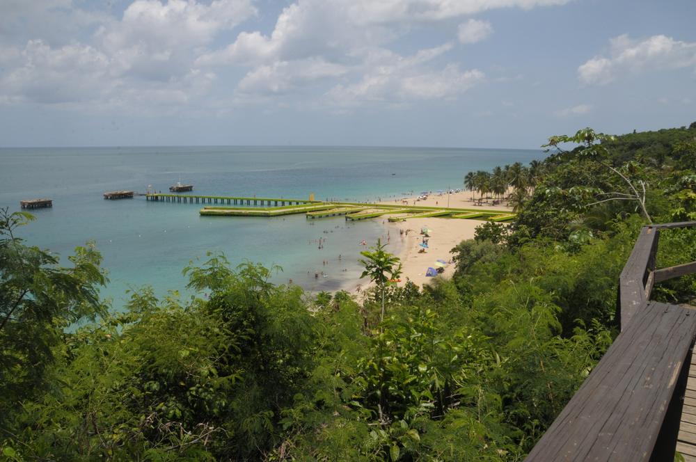
- Crash Boat Beach: free public beach; calmer water in summer, bigger surf in winter
A pier once used by the US Air Force still stands in ruins on Crash Boat Beach in Aguadilla. Summer keeps the water calm for swimming; winter swells reach 20 feet at nearby Gas Chambers and bring the surfers.
 Ktorrespr (CC BY-SA 4.0)
Crash Boat Beach in Aguadilla
Things to do across Puerto Rico
Cañón San Cristóbal
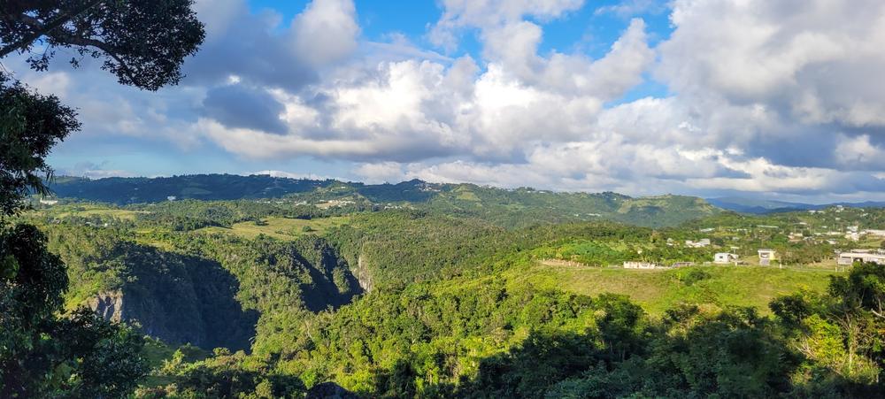
- Guided hike: full day, more than 6 miles, mostly uphill over rocky ground; unmarked trails, a guide is recommended
Hire a guide for Cañón San Cristóbal, since its trails are unmarked, and give it a full day: the hike runs more than 6 miles, mostly uphill over rocky ground. Rappelling and swimming under its waterfalls fill the route. The canyon, a 500-foot-deep cut between the mountain towns of Aibonito and Barranquitas, is unrelated to the San Juan fort of nearly the same name. Local nonprofits restored it after years of use as an unofficial landfill.
 Yarfpr (CC BY-SA 4.0)
Cañón San Cristóbal between Aibonito and Barranquitas
Cayo Santiago
- Boat charter: only designated personnel and researchers may land; tourists charter a boat to circle the island
Only designated personnel and researchers may set foot on Cayo Santiago, so a chartered boat circling the island is how visitors see it. The island, off the coast near Humacao, has been home to a free-ranging population of rhesus macaques since 1938.
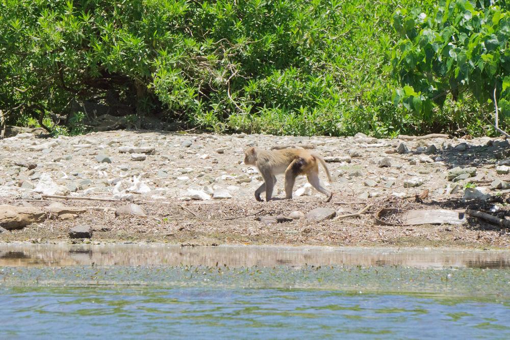 Jami430 (CC BY-SA 4.0)
A rhesus macaque on Cayo Santiago
The best places to visit in Puerto Rico at a glance
| Place | Go for | Book ahead |
|---|---|---|
| Old San Juan | the forts, the cathedral, the colonial streets | no |
| Casa Bacardí | a rum distillery tour and tasting | yes |
| El Yunque National Forest | rainforest trails and waterfalls | yes |
| Fajardo | Laguna Grande bio bay, Cayo Icacos | yes |
| Luquillo | the beach and the food kiosks | no |
| Vieques | Mosquito Bay, quieter beaches | yes |
| Culebra | Flamenco Beach | yes |
| Rincón | surfing and sunsets | no |
| Ponce | Parque de Bombas, Taíno history | no |
| Cabo Rojo | the pink salt flats, La Playuela | no |
| La Parguera | the third bioluminescent bay | yes |
| Arecibo | Cueva Ventana, Cueva del Indio | yes |
| Río Camuy Cave Park | a guided cave tour | yes |
| Toro Verde Adventure Park | The Monster zipline | yes |
| Gozalandia Falls | a free waterfall and swimming pools | no |
| Guavate / La Ruta del Lechón | spit-roasted pork | no |
| Crash Boat Beach | summer swimming, winter surf | no |
| Cañón San Cristóbal | a guided canyon hike | yes |
| Cayo Santiago | a boat pass-by of the monkey colony | yes |
Plan your Puerto Rico trip
For trip length, getting around and costs, start with the Puerto Rico guide. When you build a trip with MonkeyEatingMango, the booking checklist lists what to book and how many weeks ahead.
Last updated November 2026.
Common questions
What is the #1 attraction in Puerto Rico?
San Juan National Historic Site, the combined listing for Castillo San Felipe del Morro and Castillo San Cristóbal, has the most Google reviews of any sight in Google's Puerto Rico top-sights list: over 20,000. El Yunque National Forest is the most-reviewed natural sight, with close to 16,000.
Do US citizens need a passport to visit Puerto Rico?
No. Puerto Rico is a US territory, so US citizens travel there like flying within the US, with no passport and no customs stop on arrival. English and Spanish are both official languages, though Spanish is more common day to day.
What currency does Puerto Rico use?
The US dollar. Every price named here, from the $10 combined fort ticket to the $8 El Yunque visitor-center fee, is already in the currency you will spend.
When is hurricane season in Puerto Rico?
The National Hurricane Center states that "the Atlantic hurricane season runs from June 1 to November 30", with most activity between mid-August and mid-October. December through March, Puerto Rico's dry season, is outside that window and its busiest and most expensive stretch for travel.
How much does it cost to see Castillo San Felipe del Morro and Castillo San Cristóbal?
A single $10 adult ticket covers both forts for 24 hours from purchase, and children 15 and under get in free. The site does not accept cash.
Do I need a reservation to visit El Yunque National Forest?
Book the El Portal visitor center ($8 for adults, $4 with a federal interagency pass) through recreation.gov. Driving into the forest also needs a vehicle reservation on recreation.gov, since the road admits only a limited number of cars at a time.
Which of Puerto Rico's three bioluminescent bays should I visit?
Pick by where the rest of the trip is. Laguna Grande in Fajardo is the closest drive from San Juan, La Parguera in Lajas suits a west or south-coast route, and Mosquito Bay in Vieques is worth the ferry or flight if already staying the night there. All three glow from the same dinoflagellate and are best seen on a moonless night.
How do I get to Vieques and Culebra?
Passenger ferries to both islands leave from Ceiba, on Puerto Rico's east coast, and each island also has its own small regional airport for a short flight from San Juan. Book the ferry ahead, since tickets go on sale up to a month before and seats sell out.
How many UNESCO World Heritage Sites does Puerto Rico have?
One: La Fortaleza and San Juan National Historic Site, inscribed in 1983. The listing covers La Fortaleza, Castillo San Felipe del Morro, Castillo San Cristóbal and a third fort, El Cañuelo, together with most of the old city wall, separate from Puerto Rico's two UNESCO Biosphere Reserves, which recognize ecosystems rather than historic buildings.
What is the best time of year to visit Puerto Rico for good weather?
December through March is the dry season and the most reliable stretch of sunny days; it is also the busiest and most expensive time to go, since it draws the most tourists. May through August draws fewer crowds, at the cost of the year's hottest weather.
Is Castillo San Cristóbal the same place as Cañón San Cristóbal?
No, and the shared name is a coincidence. Castillo San Cristóbal is the Spanish colonial fort in Old San Juan; Cañón San Cristóbal is a 500-foot-deep canyon in the Cordillera Central, between the mountain towns of Aibonito and Barranquitas.

Written by Shobhit Shrivastava · Founder
Related reading
Things to Do in New Zealand and the Best Places to Visit
Where to go in New Zealand and what to do there: 16 places across the North and South Islands, each with the time it takes, what to book and the official price.
Things to Do in Norway: Fjords, Cities and the Arctic
Where to go in Norway and what to do there: the fjords, the big hikes, five cities and the Arctic north, each with how long it takes, what to book and the price, where there is one.
Things to Do in California: Best Places to Visit
Where to go in California and what to see: iconic cities, national parks, theme parks, and the coast and wine country, with time needed, what to book and the official price.