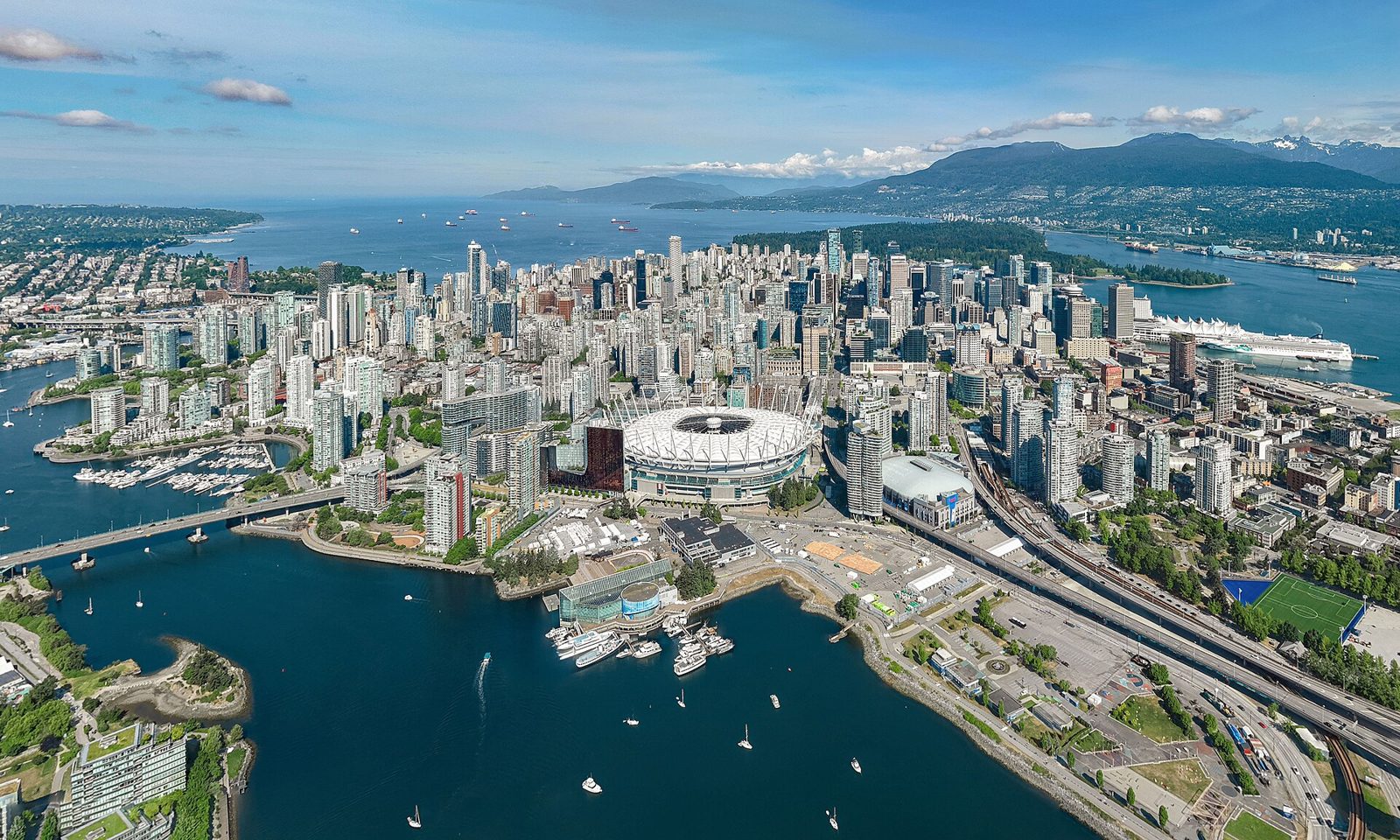
Vancouver's day-trip map runs north along the Sea to Sky Highway to Squamish and Whistler, east into the Fraser Valley to Fort Langley and Harrison Hot Springs, south to the US border and Bellingham, and west by ferry to Bowen Island and Victoria. Squamish is 55 minutes north; the Cultus Lake recreation area is 1h 25m southeast. The travel time and mode decide what fits: the mainland picks keep the road under three and a half hours round trip; Victoria by ferry is a 6-hour round trip and needs the full day.
Try free
Plan a trip in about a minute
Eight questions, a complete itinerary with budget, maps, and packing lists. No account required.
Plan a trip →All costs in this post are in Canadian dollars (CAD). Every drive time was checked against a routing source, labeled one-way in typical traffic. Ferry travel is labeled separately. The cost is an honest same-day estimate for two: transport, entries or admission, and a meal. No hotel bill, because that is the whole point.
The getaways, mapped
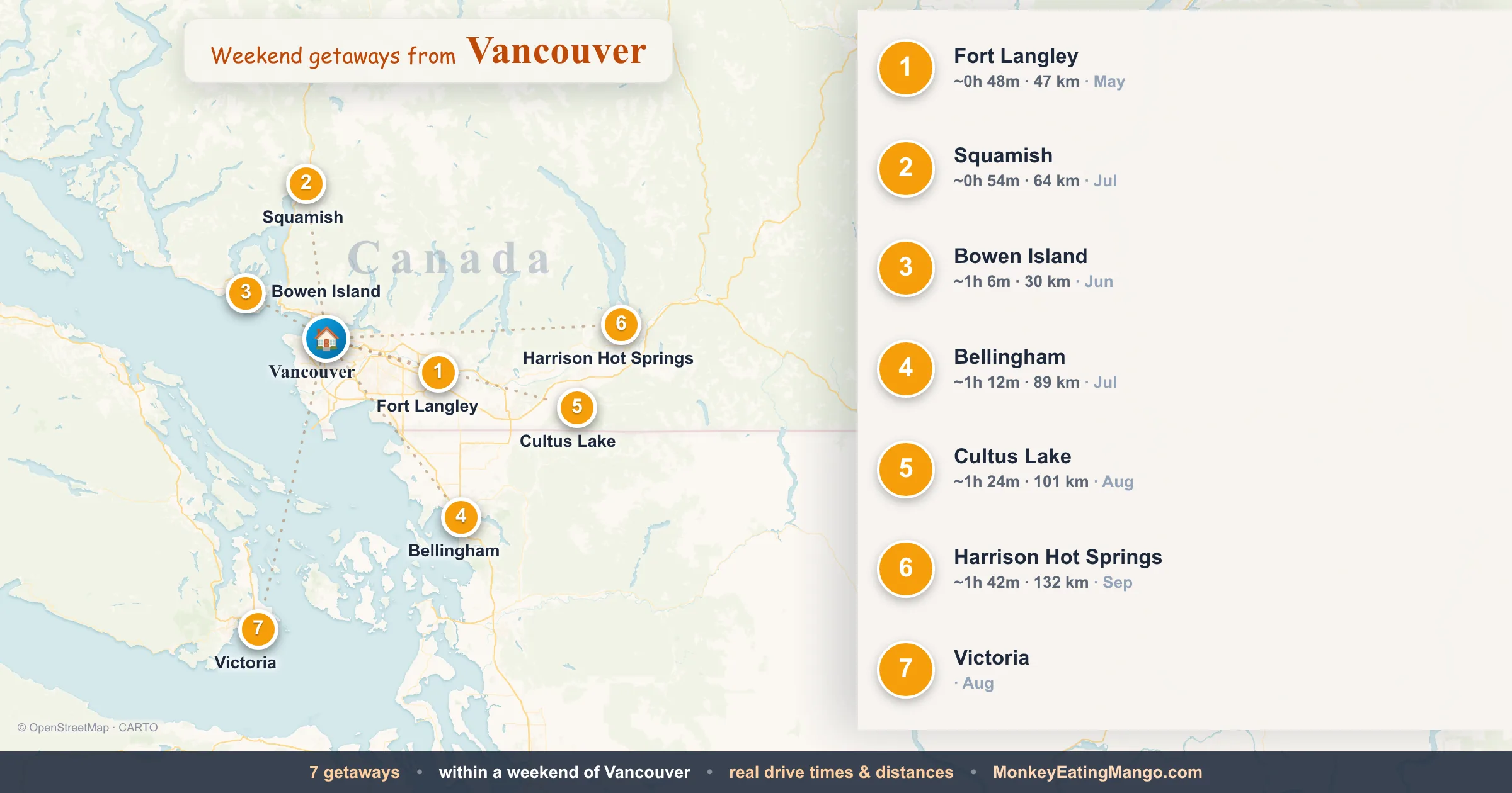
Every pick around Vancouver, numbered to match the table — with the drive and cost.
The short list
| Destination | Cost for two (day) | When to go | |||
|---|---|---|---|---|---|
| Fort Langley | ~50m · 47.3 km | ~1h 40m | Gold rush history + delta | CAD $140–210 | May |
| Squamish | ~55m · 64.1 km | ~1h 50m | Sea to Sky + mountain trails | CAD $140–210 | July |
| Bowen Island | ~1h 5m · 29.9 km | ~2h 10m | Ferry + village + coast | CAD $140–200 | June |
| Bellingham | ~1h 15m · 88.9 km | ~2h 30m | Cross-border waterfront | CAD $150–220 | July |
| Cultus Lake | ~1h 25m · 100.9 km | ~2h 50m | Freshwater lake + beach | CAD $150–220 | August |
| Harrison Hot Springs | ~1h 45m · 131.5 km | ~3h 30m | Natural hot springs + lake | CAD $150–220 | September |
| Victoria | ~3h via ferry | ~6h | BC capital + Butchart Gardens | CAD $250–360 | August |
The first six are drive picks keeping the round trip under three and a half hours. Victoria requires the BC Ferries from Tsawwassen to Swartz Bay and back, a full-day commitment. Costs run CAD $140 to $360 for two; Victoria's higher range includes return ferry tickets.
Best for the mountains
Squamish is the no-brainer outdoor day trip from Vancouver: 55 minutes north and a complete mountain landscape change.
Squamish
About 55 minutes north on BC-99, the Sea to Sky Highway, Squamish sits at the head of Howe Sound between Garibaldi Provincial Park and the Stawamus Chief. Shannon Falls, one of the tallest waterfalls in British Columbia at 335 metres, has a parking lot and a 5-minute walking trail directly off the highway. The Stawamus Chief, a 700-metre granite dome above Squamish Harbour, has multi-pitch rock climbing routes on its south face and a summit trail on the back side. Garibaldi Provincial Park, accessible from the Diamond Head trailhead 30 minutes east of Squamish, has the Elfin Lakes trail covering 22 kilometres round trip past volcanic features and a backcountry hut. July, when the park trails are snow-free and the summer light extends past 9 PM.

Squamish
Harrison Hot Springs
About one hour and 45 minutes east on the Trans-Canada and Lougheed Highway, Harrison Hot Springs sits at the southern end of Harrison Lake, the largest lake in the Lower Mainland. The Harrison Public Pool operates geothermal hot springs pools fed by the sulphur springs above town, the same water that gives the area its name. Harrison Lake itself stretches 60 kilometres north with a public beach and boat launches in town. The Sasquatch Provincial Park trail system begins at the north end of town with four lakes accessible on maintained trails. September, when the summer crowds clear and the lake water has retained summer warmth.

Iconic eats: Wild Pacific Salmon

Harrison Hot Springs
Best for the Fraser Valley
Fort Langley
About 50 minutes east on the Trans-Canada Highway, Fort Langley National Historic Site preserves the 1858 fort where Governor James Douglas proclaimed the creation of the Crown Colony of British Columbia. The fort's buildings include the Big House, the warehouse, and the bastion, with costumed interpreters and demonstrations of the fur trade and gold rush periods. The village of Fort Langley along Glover Road has galleries and shops in 19th-century commercial buildings. The Salmon River estuary at the south edge of town provides tidal flat walking and bird access on the Fraser lowlands. May, when the bald eagles return to the river and the heritage gardens in the fort are in early bloom.

Fort Langley
Cultus Lake
About one hour and 25 minutes southeast on BC-1 and BC-9, Cultus Lake Provincial Park preserves a 5-kilometre freshwater lake in the Cascade foothills of the Fraser Valley. The park has four campgrounds and a supervised swimming beach at the south end; the lake's water temperature reaches 24°C in peak summer, warm enough for swimming from late June through August. Trails in the surrounding park lead into the Tamihi Creek and Teapot Hill areas with forest walks through second-growth Douglas fir. Cultus Lake is one of the few warm freshwater lakes within a day's drive of Vancouver. August, at peak lake temperature.
Iconic eats: Wild Pacific Salmon

Cultus Lake
Island and cross-border picks
Bowen Island
About one hour and five minutes from downtown Vancouver via West Vancouver and BC Ferries from Horseshoe Bay, Bowen Island reaches the ferry terminal in 20 minutes across Howe Sound. The island's village of Snug Cove has a main street with a general store, café, and the Union Steamship Company Marina building from 1921. Crippen Regional Park covers the island's interior with trails to Killarney Lake (3.5 km one-way through old-growth forest) and the Howe Sound Crest Trail above tree line. The island has around 3,800 full-time residents and no traffic lights. June, when the days are long but the summer ferry crowding hasn't peaked.

Iconic eats: Smoked Salmon Candy

Bowen Island
Bellingham
About one hour and 15 minutes south on BC-99 and I-5 through the Peace Arch border crossing, Bellingham, Washington, sits on Bellingham Bay with the North Cascades and Chuckanut Mountains as its backdrop. Whatcom Falls Park, two miles east of downtown, has a stone bridge over the falls and 4 miles of trails. Boulevard Park runs along the Bellingham Bay waterfront at the end of State Street with views across the bay toward the San Juan Islands. Fairhaven, the Victorian-era neighbourhood south of downtown, has galleries and the independent Village Books on Harris Avenue. Bellingham's North Coast Trail provides the most accessible mountain biking in the area. Add 30–60 minutes for the Peace Arch or Pacific Highway border crossing each way. July, when the bay views are clear and Chuckanut Drive's cliffside road opens fully.

Iconic eats: Coffee, Marionberry Pie, Pacific Oyster

Bellingham
Victoria
About three hours from Vancouver via BC Ferries from Tsawwassen to Swartz Bay (a 1h 35m sailing) plus the drive to the terminal and into Victoria, the BC capital sits on the southern tip of Vancouver Island. The Inner Harbour hosts the BC Legislature building and the Fairmont Empress Hotel on the waterfront. The Royal BC Museum on Belleville Street covers Northwest Coast First Nations culture and the region's natural history. Butchart Gardens, 22 kilometres north of Victoria in Brentwood Bay, maintains 55 acres of formal gardens in a converted limestone quarry with rose, Italian, and Japanese garden sections. Victoria's Chinatown on Fisgard Street is the second-oldest in Canada. August, when the gardens are at peak and the ferry schedule runs frequently.

Victoria
Getting there and getting around
All mainland picks are drives from Vancouver. BC-99 north (Sea to Sky Highway) reaches Squamish; the Trans-Canada east reaches Fort Langley and Harrison Hot Springs via Lougheed Highway. BC-1 east and BC-9 south reach Cultus Lake through Chilliwack. BC-99 south and I-5 reach Bellingham after the Peace Arch crossing. Bowen Island leaves from the Horseshoe Bay Ferry Terminal on the north shore. Take the Lions Gate Bridge or the Upper Levels Highway from Vancouver. Victoria ferries leave from Tsawwassen Terminal south of Vancouver. Take the George Massey Tunnel or Alex Fraser Bridge toward South Delta.
The Sea to Sky (BC-99) can slow through West Vancouver on weekends. The stretch above Horseshoe Bay runs two lanes without overtaking. Harrison Hot Springs' road east of Agassiz is clear but follows the river valley; allow extra time after the turn off Highway 7. Peace Arch border crossings can run 60–90 minutes on summer weekends; the Pacific Highway crossing two kilometres east is sometimes faster.
Common questions
What's the best day trip from Vancouver? Squamish at 55 minutes north for Shannon Falls, the Chief, and Garibaldi Park access. For history, Fort Langley at 50 minutes east.
Is Victoria worth a day trip from Vancouver? Yes, but it's a 3-hour ferry trip each way. Butchart Gardens, the Inner Harbour, and the Royal BC Museum justify the travel when a full day is available.
What's the closest day trip from Vancouver? Fort Langley, about 50 minutes east: the National Historic Site where British Columbia became a Crown Colony in 1858.
What's a good nature day trip from Vancouver? Squamish for the Sea to Sky mountains, Cultus Lake for warm freshwater swimming in the Fraser Valley, or Harrison Hot Springs for the geothermal pools on Harrison Lake.
Can you do a cross-border day trip from Vancouver? Yes, Bellingham at ~1h 15m via Peace Arch. Budget an extra 30–60 minutes each way for the border.
How much does a day trip from Vancouver cost for two? All costs are in Canadian dollars. Most mainland picks run CAD $140–220. Victoria by ferry reaches CAD $250–360 with ferry tickets included.
The bottom line
The best day trip from Vancouver is the one that matches the travel mode and the day. Squamish and Fort Langley at under two hours round trip are the no-commitment picks. Bowen Island's 20-minute ferry adds character without the full-day commitment. Bellingham gives a cross-border option; Harrison Hot Springs earns the longer drive for the hot springs. Victoria is worth a full day when the ferry timing works. Plan your day trip free and the planner ranks these for your exact date, group, and budget.
Browse more day trips by city, or for an overnight see the weekend getaways from Vancouver.
Drive times verified against routing sources August 2026; BC Ferries schedules subject to change. Confirm sailing times before you travel.
Written by Namrata · Editor
Try free
Plan a trip in about a minute
Eight questions, a complete itinerary with budget, maps, and packing lists. No account required.
Plan a trip →Sample itineraries
Vienna, Austria
Austria · 4 days itinerary
Grand Canyon, United States
United States · 3 days itinerary
London, United Kingdom
United Kingdom · 3 days itinerary
Lisbon, Portugal; Lagos, Portugal
Portugal · 7 days itinerary
Related reading
Day Trips From Toronto: Drive Times & Cost
Seven day trips from Toronto, each with a verified one-way drive time and an honest same-day budget for two. Hamilton's waterfall circuit is 55 minutes west; Prince Edward County's Sandbanks Provincial Park, at 2h 25m east, anchors the far end of a summer day.
Day Trips From Ottawa: Drive Times & Cost
Seven day trips from Ottawa, each with a verified one-way drive time and an honest same-day budget for two. Wakefield is 30 minutes north in the Gatineau Hills; Montreal, the second-largest city in Canada, is 2 hours east on the 417.
Day Trips From Calgary: Drive Times & Cost
Seven day trips from Calgary, each with a verified one-way drive time and an honest same-day budget for two. Cochrane is 35 minutes west; Canmore, the Rocky Mountain town at the edge of Banff National Park, is 1h 10m west on the Trans-Canada.
Canada Itineraries
Day-by-day plans with real cost breakdowns
Banff, Canada
5 days
5 days in Banff: base yourself on Bear Street or near Banff Avenue to balance accessibility with quiet. Experience the Mount Norquay Via Ferrata, paddle the turquoise waters of Lake Louise, and soak in the Banff Upper Hot Springs. Comfortable pace with 2-3 deep nature activities daily and local...
Niagara Falls, Canada
2 days
A comfortable 2-day trip split between the intense roar of Horseshoe Falls and the quiet, vine-covered heritage of Niagara-on-the-Lake. Experience the Journey Behind the Falls, hike the Niagara Glen Nature Reserve trails, and spend an evening at the Shaw Festival Theatre. You will base yourself...